This map shows the land cover in the Nordic Region in 2012. Land cover data indicates the physical land type, helping to understand the current landscape of an area.
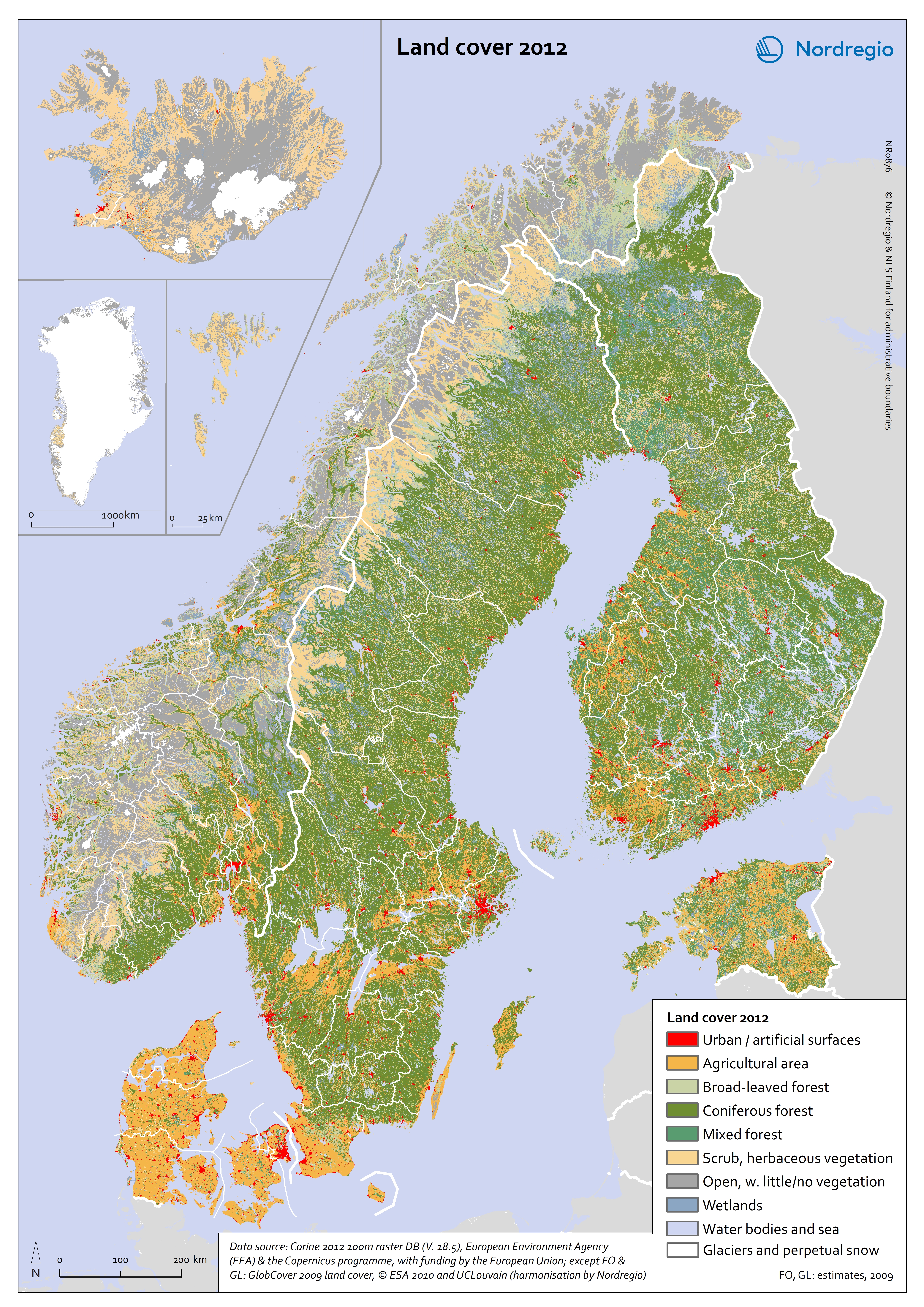
The different colours represent land cover types with urban/artificial surfaces in red, agricultural areas in orange, forests in green, scrub and herbaceous vegetation in yellow, bare ground in grey, water bodies in blue and glaciers and perpetual snow in white.
There are significant differences between the Nordic countries in terms of their land use. Denmark is largely agricultural (62%), while Finland (73%), a large part of Sweden (69%) and south-eastern Norway (28%) are all dominated by forest, mainly coniferous. Iceland and the Faroe Islands have large areas of scrub and herbaceous vegetation, suitable for grazing livestock. Open land with little vegetation is significant for many regions in Norway and Iceland. Vast parts of Greenland and parts of Iceland are glaciers. The Nordic countries all have long coastlines and easy access to marine resources.
The map is a Corine 2012 raster DB (V. 18.5) at 100m resolution from the European Environmental Agency and the Copernicus program, with funding by the European Union. For Faeroe Islands and Greenland the data is from GlobCover 2009 land cover, ESA 2010 and UCLouvain (harmonization by Nordregio).